
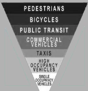
Walking in the County southeast past the shops at Stonefield. Enjoying the new sidewalk and trees. Headed home. Arriving at the “Main Street” of the County, US Route 29, the neighborhood model takes on a new light. How is the pedestrian meant to cross into Charlottesville? Carefully. Not sure exactly how many lanes there are, standing on one side they are a challenge to count. Big asphalt. Twelve lanes?

There are lots of hashmarks scattered about the intersection, providing guidance to motorists about how to negotiate the DMZ. I didn’t see a crosswalk.
It seems that “transit” in the county means four wheels and a motor. If you have the misfortune to engage in bipedal locomotion, be fleet of foot. What momma said. Look both ways before crossing this road.
In an alternate reality.
Category: Urban Planning
big tent
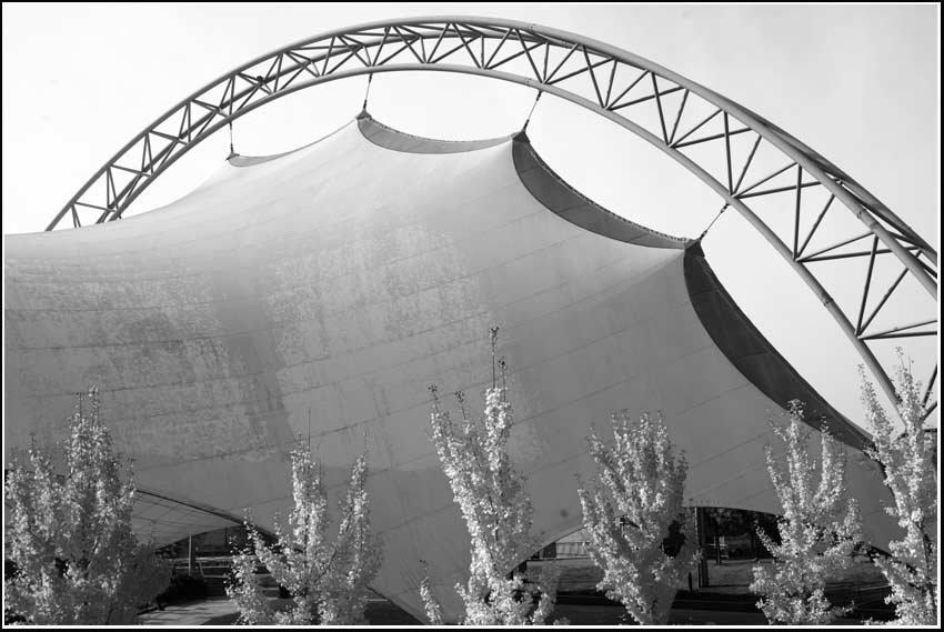
The big tent in the little downtown. The tent blocks former mountain view but provides seating for political and musical events. Was this a custom tent or an off the shelf model?
impervious
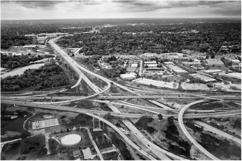
Years ago our transportation planner jokingly broached the option of building a moat around our little city.
The moat, to protect city residents from vehicles short cutting through their neighborhoods while cruising
from point A to point B in the surrounding suburbs.
Another possibility, convert the City to a gigantic high speed interchange.
Complicated Acronym
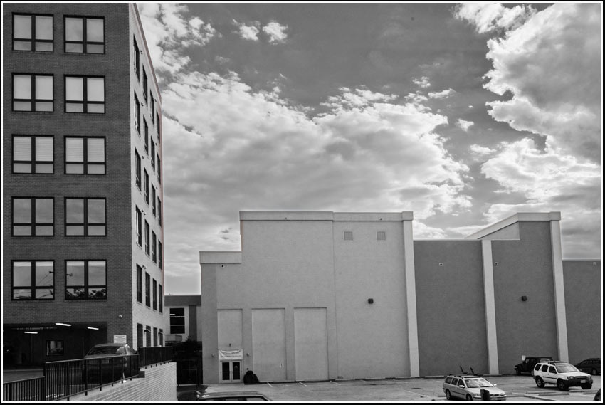
fenestration and lack thereof. Good place for a mural.
PURPOSE AND CHARGE
There is hereby created the Placemaking, Livability and Community Engagement (PLACE) Design Task Force (PDTF) to act as an advisory body to the Planning Commission and City Council charged with the following:
1. Reviewing and advising on the urban design aspects of development projects on publicly owned or financed land and developing design criteria for such projects.
2. Reviewing and advising on the design of city capital projects and changes to existing public facilities.
3. Reviewing and advising on proposals for public art.
4. Reviewing the status, adequacy and appropriateness of current landscape and streetscape standards city-wide and recommending improvements.
5. Reviewing existing urban design guidelines and their implementation and identifying and recommending new or additional city-wide best practices for urban design guidelines and their implementation as required.
6. Reviewing special projects as requested by City Council or the Planning Commission.
7. Identifying the obstacles and recommending incentives for the redevelopment of our growth corridors while still fostering good urban design and placemaking.
8. Identifying best practices in master and small area planning, public space design inclusive of street and corridor standards and their implementation and city-wide public engagement processes.– March 5, 2012 Charlottesville City Council
Curiosity
Corner of Cedar Hills and Hydraulic Road. The trees in this part of town are disappearing, soon to be replanted along the grand boulevards of Stonefield. I suppose the trees in the Route 29 median are gone for good.
Has the Muse of Architects been communicating on a regular basis with the builders of Stonefield? Will the addition of veneers, nature band-aids, signage, street lights and grifters make it feel more like Charlottesville? While the grifters might not be welcome to loiter and panhandle in the interior of Stonefield they’ll probably be able to set up along the Hydraulic frontage in the public right of way.
Curiosity (Martian rover) landed today. (illustration below courtesy NASA/JPL-Caltech)
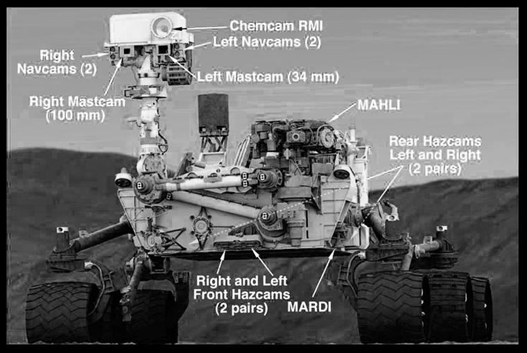
Look at it. It has cameras, wheels, it is looking for something. Looking for the trees and where did all the Martian water go? Curiosity has a Twitter Feed.
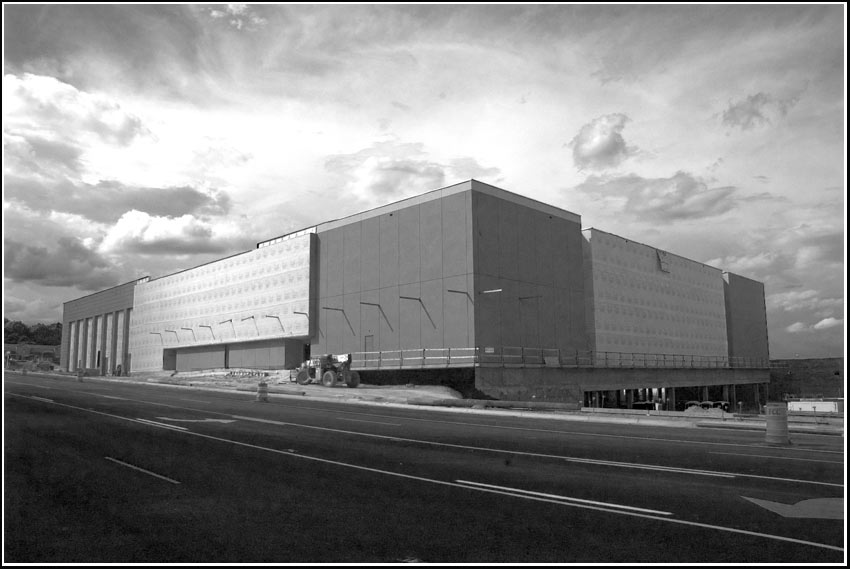
When will the Big Windowless at Stonefield be activated? Is it a DT mall slayer robot?
Will it spew cars through Cedar Hills neighborhood? Is there a water feature? Does Stonefield have a Twitter Feed?
stealth bus stop
Through sensitive selection of signage, appurtenances and plantings this Charlottesville Area Transit bus stop fits comfortably in a rural central Virginia neighborhood.
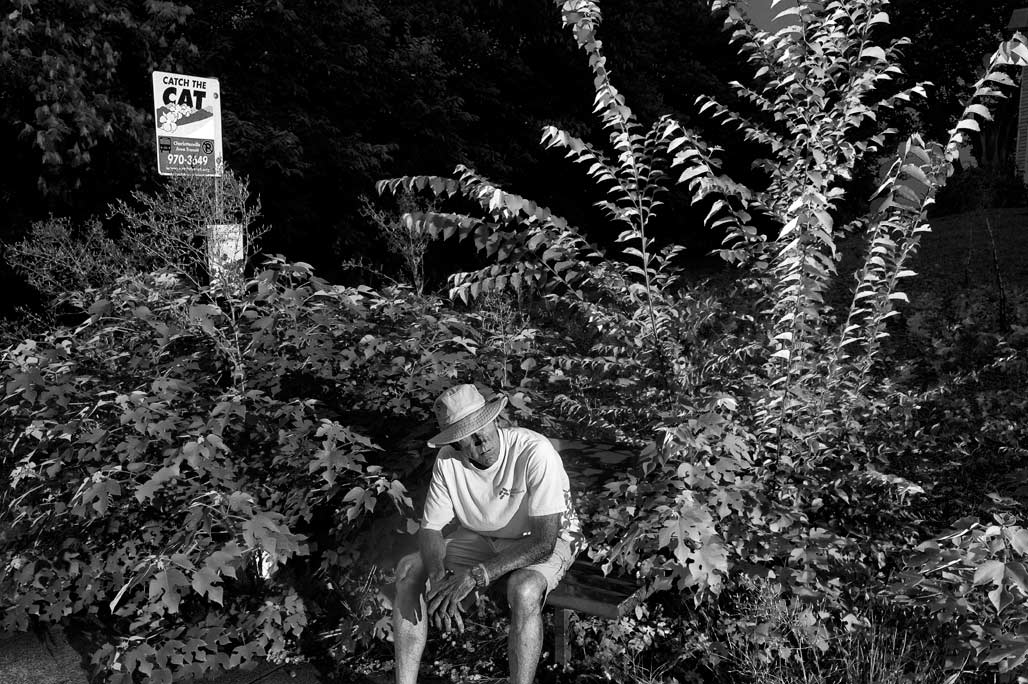
reenactor
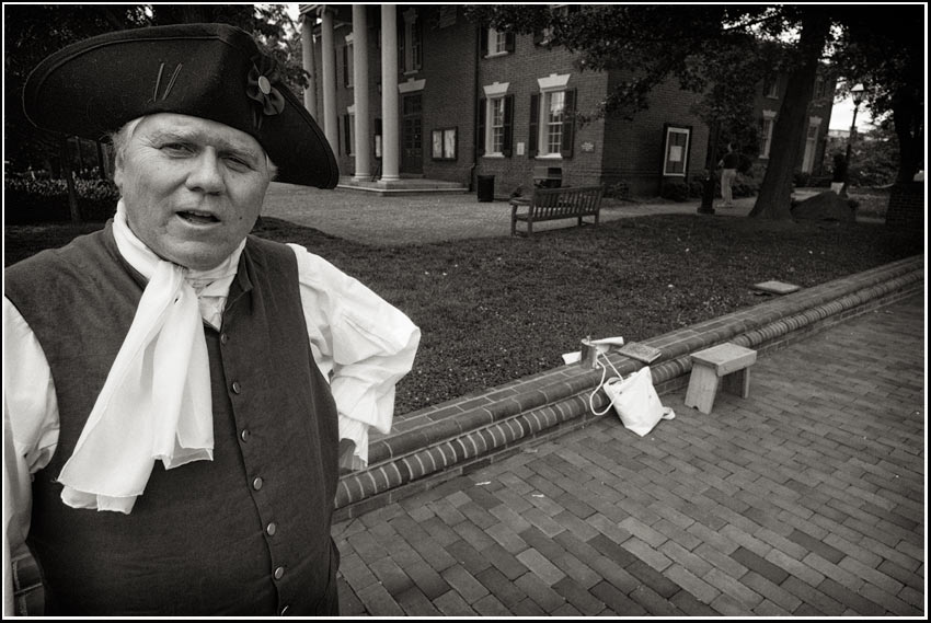
Charlottesville was established as a gridded town plan from the start. Dr. Thomas Walker was assigned by the County as Trustee, and a two acre public square was set aside for the courthouse at the northern edge of the fifty acre town. The site for the courthouse was selected on a hillside directly above the gridded village, several blocks above Three Notch’d Road or the main street of town. Over time, business activities around the Court Square included taverns, tailors, milliners, a printing shop, a gunsmith, and a jeweler. A portion of the original courthouse (1803) still stands as a part of the current complex of structures. The original twenty-eight block grid corresponds to the following existing streets: Sixth and McIntire on the east and west respectively, Jefferson and South on the north and south. A plan from 1818 indicated east/west streets as 66 feet in width, while north/south streets as 33 feet wide; this plan also indicated a two block by seven block annexation added directly to the north of the original grid.– Ken Schwartz
A Short History of America
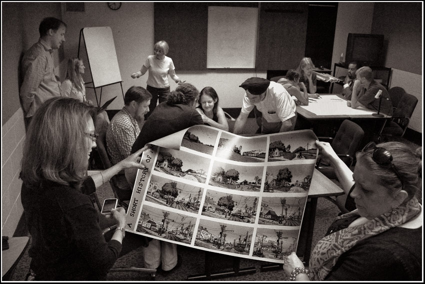
R. Crumb’s image made a cameo appearance at the Charlottesville City work session on land use June 7. Originally this image of landscape metamorphosis was in black and white and not set to music.
neighborhood model
My introduction to real estate advertising was an issue of Mad Magazine in the 1960’s.
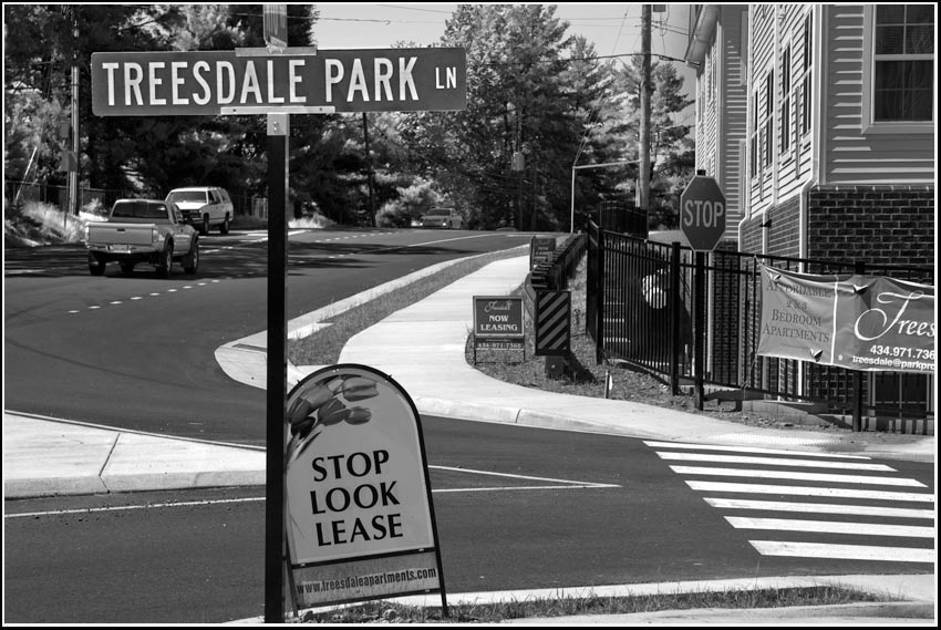
Honest to goodness, discover Treesdale.
Note the three foot wide planting strip to the left of the sidewalk on the edge of Rio Road. Where are the trees to shade pedestrians?
Where is the “planting strip” wide enough to support trees?
(Techniques outlined in the magazine seem to be in play here.
Name your real estate development what it is not.
Formerly this section of Rio Road was lined with massive oaks…)
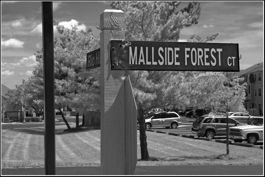
Land use planners have spent too much time focusing on numbers: the number of units per acre, the number of cars per hour, the number of floors per building, and not enough time on the values, customs, characteristics, and quirks that make a place worth caring about. Edward T McMahon
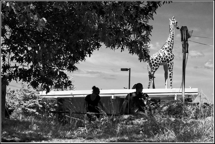
Dazzle with a clever name. Put a giraffe on the roof.
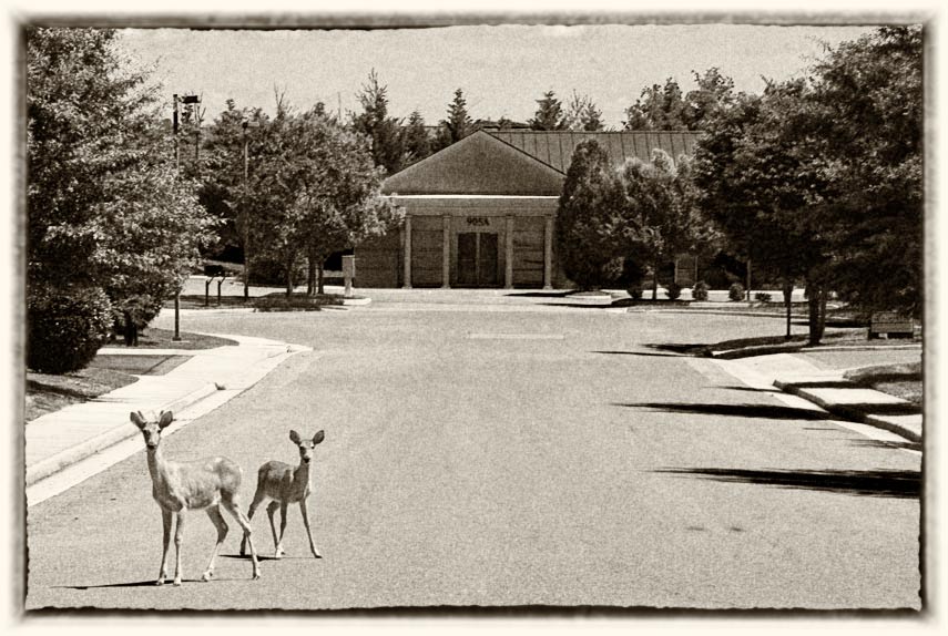
I believe the name of this development is the East Rio Office Park. Dentists, lawyers and deer. I challenge any member of the Albemarle County Board of Supervisors to walk Route 29 from Rio Road to the City line and say:
“I don’t see the need for Places 29”
These neighborhoods and their centers will be pedestrian-oriented and mixed-use; they will offer a variety of housing choices, retail environments, office types, and employment opportunities. They will be connected by an attractive, efficient, and accessible multimodal transportation system.–AlbCo Community Development
scary
My fears regarding the future of neighborhoods? Cut them open to get to the golden eggs, trade them for a handful of magic beans, shrink National Historic Districts and ADC’s to the size of handkerchiefs, widen roads, install sewage pipes in the air, cut down the trees, fire engines everywhere. Anything is possible.
Charlottesville Tomorrow has the story: