the floodplains shall be filled, the mountain and hill shall be made low: the crooked shall be made straight, and the rough places smooth.
Albemarle County Supervisors vote 4-2 to further terraform at the base of Monticello mountain.
Mallek and Missel voted to prevent harm in the flood hazard overlay district and to retain the benefits of ecosystem services provided by Albemarle’s green and riverine systems to inhabitants of the County and City.
Duncan, Gallaway, LaPisto-Kirtley and Pruitt voted with the civil engineers to acquire four metal buildings, impervious surface and tax revenue.
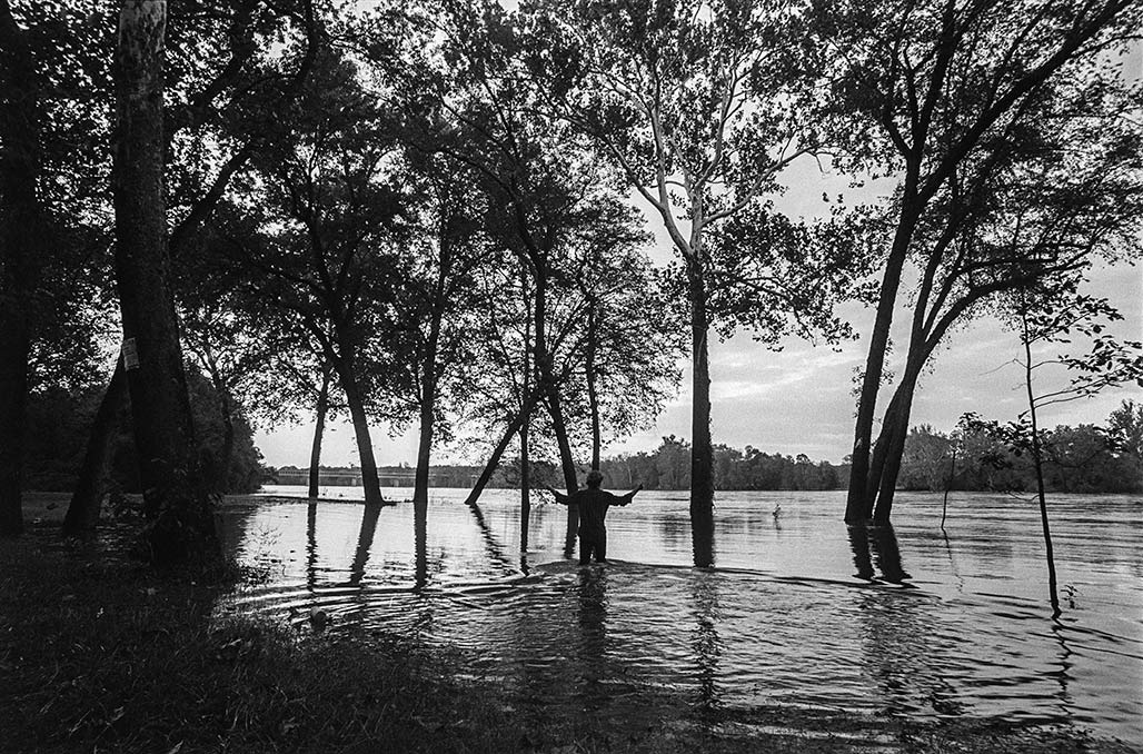
James River floodplain south of Hugenot Bridge
I would like to throw in a different thought than what we’ve been talking about. So we’ve been talking all evening about storm water volume and flows and base flood elevations and floodway fringes and floodplains and 100 year floods and 500 year floods. And I’m well familiar with all these terms, because I spent more than 30 years running a national stream and wetland habitat restoration program across the entire United States, but I also spent over a decade surveying the biological integrity of Moores Creek. So I’m really familiar with this.
I was also vice president of the Belmont Neighborhood Association. I lived there for many years. So I know that neighborhood really well. I know the county side really well. So we’ll just establish that, but we haven’t talked about the other purposes that a floodplain provides.
It is not simply a zone where water is stored during a high water event. It does serve to dissipate the energy of flood waters. Yes, you do want them to be able to spread out and slow down, because they’re less erosive than if you push them into a funnel and let them go really fast, and that’s why we don’t like filling in the floodplain, because it constricts that flow and makes it go fast.
So we can accept the engineers analysis that they say that because this is a backwater fill situation where the water, as the Rivanna River, rises, it backs up Moores Creek, but that they have done all their calculations to say that this small area fill will not raise the base flood elevation. Fine, I’m not going to argue with that.
All right. I’m not an engineer, although I do work with a lot of engineers, but we haven’t talked about the fact that there’s other things that go on in the floodplain that are also really important.
This is habitat. This is not simply an exercise in water flow, but it is also a habitat where many different species depend on that riverine habitat.
Riverine is not a word that we’ve heard tonight that refers to that unique habitat that exists along the river. And those of you who canoe or hike or spend a lot of time in the water understand that that is a different environment than the upland environment.
So to quote the Department of Wildlife Resources, Moores Creek, which flows to the city of Charlottesville, is a tributary to the Rivanna. For decades, urbanization and manipulation have degraded the habitat and water quality of Moores Creek. And it goes on and talks about the potential for Moores Creek to be restored, and notes that multiple species of greatest conservation need listed in Virginia’s wildlife action plan could potentially live in Moores creek or the Rivanna river, and they go on to list all the different species.
Just because we have urbanized the watershed doesn’t mean we should continue to degrade it, just because we thought it was a good idea decades ago that we would put industrial uses along a river that that’s still a great idea.
Zoning can be old and stale and a bad idea, and so the underlying zone here is a bad idea, and I understand that that’s not what’s before us tonight. What’s before us is, can we let them fill in the floodplain?
So there’s a reason why the Comprehensive Plan listed this as parks and green systems. It’s because it’s a flood plain, right? That is why, and the floodplain isn’t just about floods, as I said. So I would like to mention some of the other stakeholders who are not here tonight to testify. And I’m going to save you me rattling off hundreds of species and put you in a coma. I’ll just list a few, the great blue heron, the little green heron, the salamander, the kingfisher or the red bellied woodpecker. I could go on and on with a list of aquatic and riparian species that depend on that habitat. And when we fill it and we destroy it, we diminish that.
So you might say, well, this is just a small area. We’re just going to destroy that small area, because you will destroy it when you fill it and put industrial uses on top of it. But my mom used to use this phrase. You’ve probably heard, death by 1000 paper cuts. That’s what’s wrong with Moores Creek, that’s what’s wrong with the Rivanna river. And so I don’t want to continue to do bad things just because FEMA says, If we pile a bunch of dirt tall and high enough, we’ll be outside the floodplain.
We can engineer just about anything. And I’m going to give you a quick example, I promise quick, that will help you understand the fallacy of this type of thinking.
Let’s just talk about what you can do regulatorily. We could pipe all the creeks. We could get permits from the Army Corps of Engineers. We could pipe our creeks, we could put dirt on top of them, and then, guess what? We won’t have floodplains. Then we could develop on top of all of the prior creek areas, because we could have more industrial use.
Isn’t that great?
No, it’s not great, because rivers and riparian systems provide so many other benefits, habitat areas of respite, quiet, solitude, and habitat for species that, frankly, don’t survive and thrive in other places. And so it’s up to you, if you want to take the attitude that with good engineering and enough bulldozers, we can make it work, and we can meet the federal regulations, but we’re not hitting the spirit of the law, which is to try to protect the aquatic resources of our state. So I’m just, I’m going to leave it there.
I’m opposed to this application. I’m opposed to all filling of floodplains for that reason. And there’s a reason why the Comprehensive Plan said this should be parks and green systems, and I’m sticking with the Comprehensive Plan. I’ll leave it there. I’ll only talk again, if there’s some technical thing that I want to object to, but that’s where I stand. Thank you.–Commissioner Karen Firehock December 16, 2025, Albemarle County Planning Commission meeting
Albemarle BOS will vote the fill up or down January 14, 2026. There is a petition asking them to deny this application to fill, please consider weighing in.
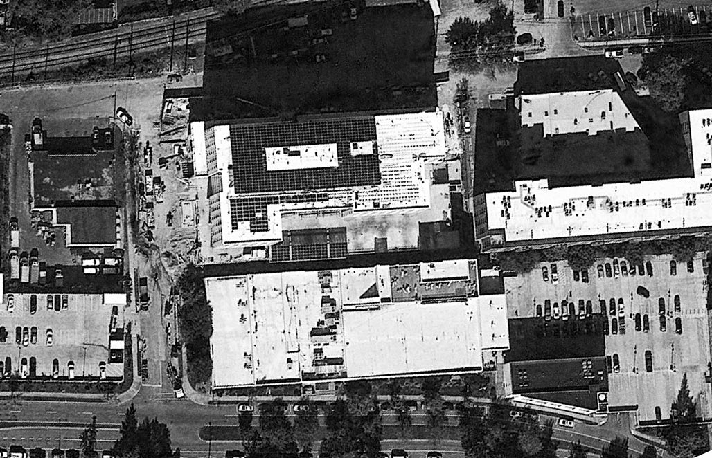
I certainly do not disagree with the technical attributes my colleagues have shared and I will go on record by saying I hate this image that I’m looking at right here. Look at the neighborhood to the left of Franklin St. What socioeconomic band do you think those people are in? Where else in our county would you see something like this?
Q-Proximity to an industrial park?
A-Right! I mean, talk about design injustice, on top of all the things that my Commissioners have said, there’s a reason why the comp plan says what it says. There’s a reason why we don’t commonly build in the floodplain. There’s a reason why you can’t put a building on there today. Like those reasons are there for a purpose. I won’t go ahead and beat the drum that my previous two Commissioners have. I certainly agree with them. They’ve said it so eloquently. So I’m a pretty hard no on this one.– Commissioner Corey Clayborne 4/22/2025
Bulldozer in the foreground, Monticello in the background, floodplain in between.
There’s lots of things that we can do with engineering, with big machines and modern equipment. I mean, there are lots of things that one could do.
And so we do have the ability to build up the soil and help create an island, an elevation that will then put a structure that is out of the 100 year floodplain. That’s true.
We also could pipe the creek and pave it over and then we wouldn’t have to have a buffer. You could actually get a permit from the Army Corps of Engineers to do things like that.
But should we?
That’s where I’m coming from. The 100 year floodplain has a very important hydrologic function in allowing, during a storm, as a water is rushing down, because it has this area it spreads out and dissipates the energy of the water and then some of that sediment load actually drops out in that slower water at the margins. That’s why floodplain soils are so rich, that’s why people like to farm them, because it’s some of the best soil, because that’s where those floodwaters dissipate and lose their energy.
When you constrict the area that the water is flowing through it goes faster. So on a large scale, looking at the whole area, I understand what Mr. Pohl is saying and I understand what Timmons has said, that this will not raise the elevation of the flood overall.
But I’m also looking at this from two perspectives; one is death by 1000 paper cuts, which is all the little fills cumulatively altogether, I don’t have the confidence that we’re looking at it from that perspective.
The other aspect is, again, what I just said about floodplains. They have a purpose and we really should not build in the floodplains. Albemarle County is actually more restrictive; we don’t let you put subdivisions in the floodplains.
You know, our neighbors in Charlottesville allowed a development of housing in the floodplain through an area which I used to kayak when the water was up.
And too bad for those folks when we get another big storm.
I believe very strongly and I have a 35 year career in floodplain and watershed management, and so I’ve spent my whole life trying to keep people out of floodplains.
I would also suggest to you that the zoning, yes is from 1997. But in our comp plan, never mind the park thing for a moment to my commissioner at the other end of the dais, they’re not suggesting this become a park necessarily, but it’s designated as green system because the county did go along and say all of these floodplains, we’re going to call them green systems.
Don’t always think of the Earth as just a place where we are going to recreate or not recreate. There are other ecological functions that are going on there for biota, for salamanders, for all kinds of other critters that are also under our stewardship.
Where I’m coming from is I’m not in favor of allowing fill in the floodplain.
I think that zoning can be old, zoning can be wrong. Zoning can be a bad idea. I think this zoning is outdated. I agree with Lonnie. There are a lot of a lot of reasons why we developed along rivers, that was because that was a transportation system. We had to move goods on the Rivanna. We put goods on batteaux on the Rivanna and sent them down to Richmond. So you know, there’s a lot of reasons why people develop near rivers, also for water supply.
But today, putting industrial along our rivers is also a bad idea. So I don’t think the zoning is good. We’re not here tonight to decide about the zoning, we are here to decide whether you think it’s OK to fill in the floodplain. And I’m going to stick with the comprehensive plan. I think it was wise to say that this is a green system and I don’t care if no one ever recreates in it. So that’s where I’m coming.
I have a lot of hydrologic reasons and ecological reasons for the way that I am presenting my position tonight. I don’t think we’re getting a huge return for allowing this site to become this industrial use by getting it out of the floodplain. That’s it.
I will now step down off my soapbox and yield to my colleagues.–Karen Firehock April 22, 2025 Albemarle County Planning Commission
Councilor Szakos said she understands that the person who built this are not the same people coming forth with the application. Can we assume that when this was built, the zoning would not permit a triplex there so it was being built as a single family home? Mr. Haluska said the previous owners had begun work on a structure that is technically allowed under the city’s zoning code, but the proposed use as three apartment units is not. The original building plans for the project were for a 7,000-square-foot, single-family detached residence.ZM15-00004 June 2016 Planning Commission
Mary Carey 100 Ridge Street; said she appreciates what Planning Commission has done not agreeing with everything.
She said you’ve done good and a lot of people don’t give you the praise you should get. You are making people feel you
are dealing with the people and not the developers, because the developers are taking over our city. It’s all about money.
It seems a majority of Charlottesville City Councilors feel that the structure at 624 Booker is house sized (their current definition of house sized is 9500 sq ft) and could be built on any residential lot in Charlottesville?
Once upon a time no one had heard of Charlottesville. That changed in 2017. Surfs up! 2023 the City continues catching the wave of notoriety. Some call it “punching above our weight”. Some call it ill-advised.
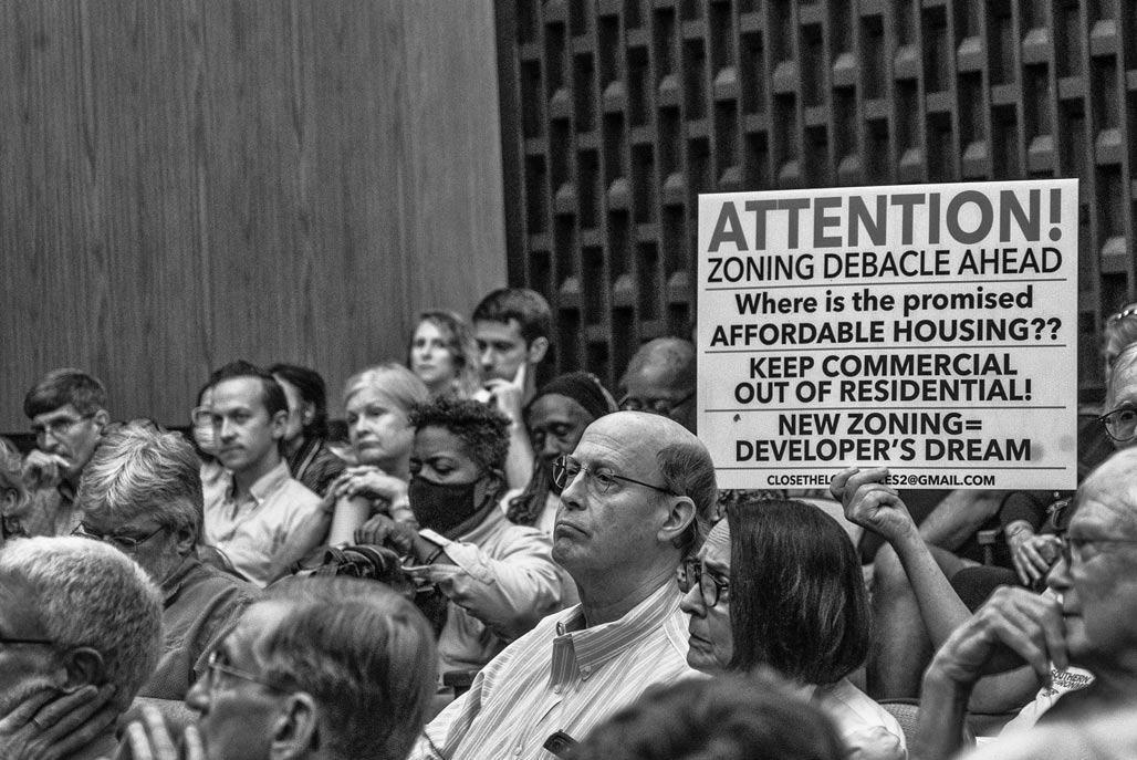
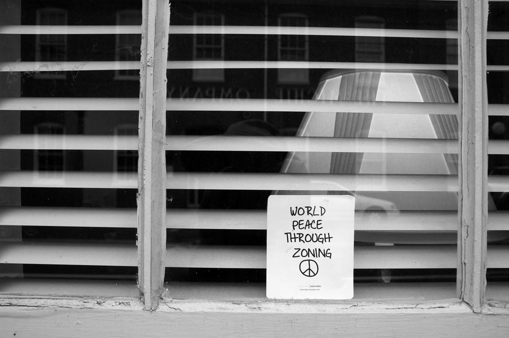
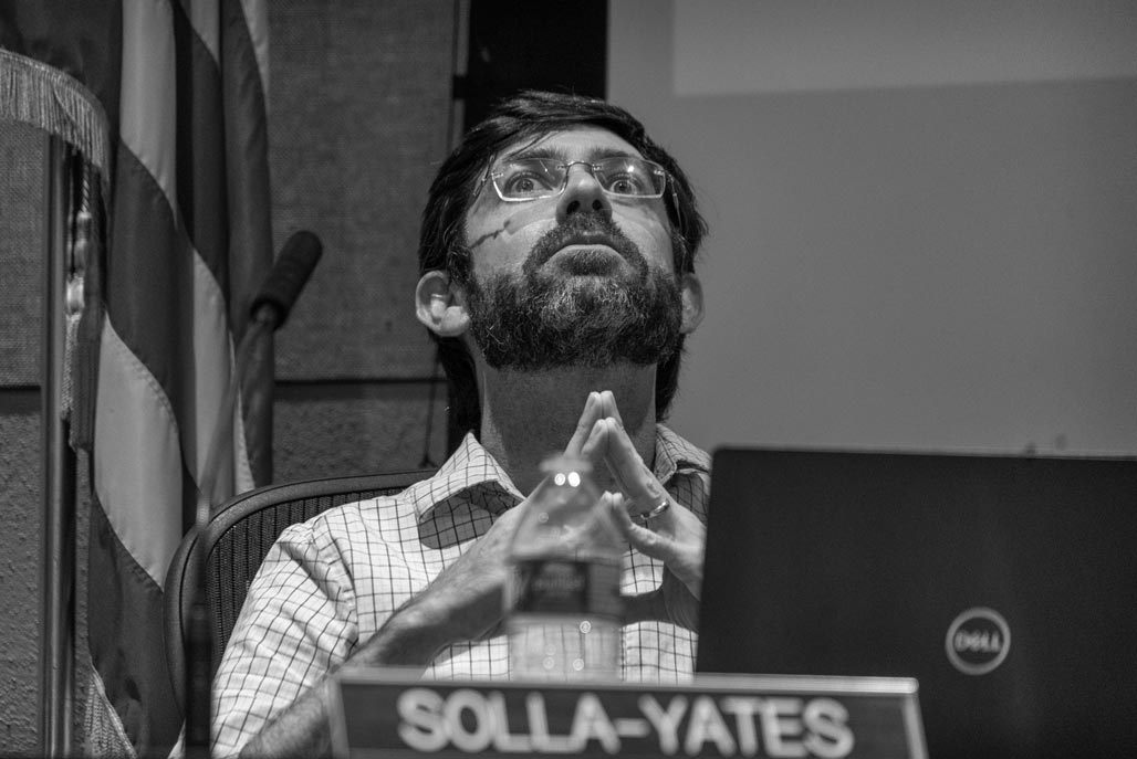
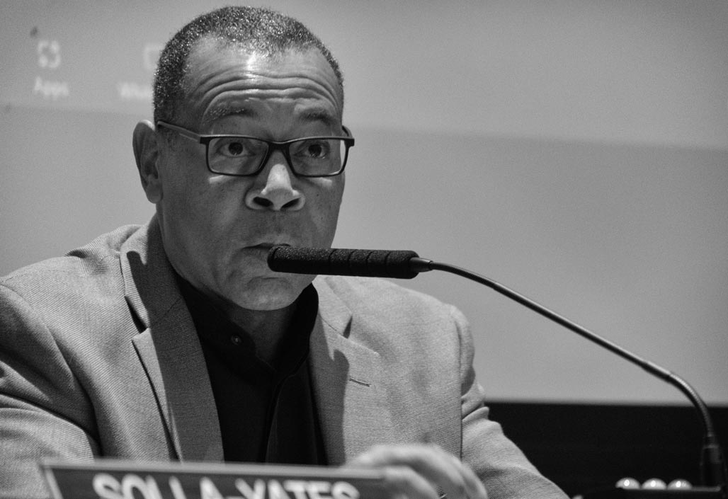
What can zoning not fix?Commissioner SchwarzCommissioner StolzenbergCommissioner d’OronzioCommissioner Solla-YatesChairman MitchellCommissioner HabbabSeptember 14, 2023, draft zoning ordinance Public Hearing, 110 speakers…
Dear Commissioners,
I appreciate your efforts to address displacement pressure, it is a great challenge.
People need safe places.
I think of the decades of back and forth with the Council and the Commission over the disposition of a handful of lots on Market Street and you all are contemplating catalytic changes to thousands of lots.
Wow.
I hope you are as wise as Solomon. I pray that your recommendation to Council doesn’t have as many unanticipated/untoward effects on our City as the arrival of the automobile.
As you strive to do good strive also to limit the damage.
The City is a sensitive living thing.
Good luck
Charlottesville is riding the zoning wave.
The implementation of the draft zoning ordinance will further decrease the City’s shrinking tree canopy. How low can the canopy percentage go? The code writers say we can’t ask developers for more than 20% canopy coverage, the State’s maximum requirement.
But developers and landlords can be incentivized,
the code’s green-scape zones and setbacks can be adjusted
and we can ask our City Councilors to join us in this goal.
Look at the money. The City takes in 100 million in real estate tax, the city spends one thousandth of that planting trees.
We talk the green City talk, let’s start walking the walk.
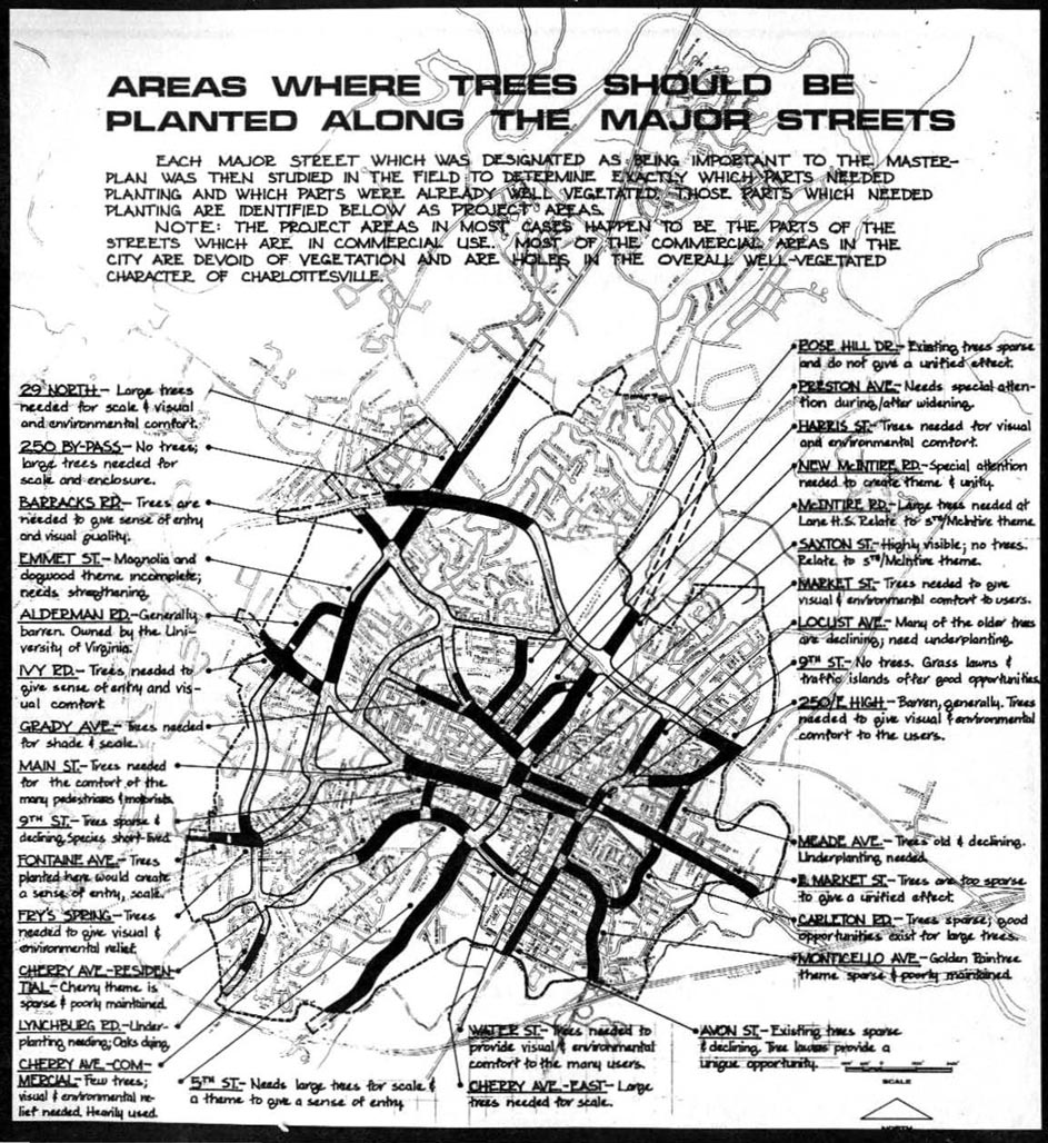
Trees and density can coexist, you just act. Plant a $10 tree in the ground, care for it, and step back. 1975 street tree plan
In 1975 the City had a plan to plant a multitude of trees in the commons, in the right of way. In the Woolen Mills 90 trees would line East Market Street from Firefly to the Rivanna. Shade, walkability, habitat, carbon sequestration, oxygen production, stormwater control! Of the 90 trees, one has been planted at 1606 E Market.
Square that lack of follow through with the Standards and Design Manual chapter 9.6.4 which reads
“Trees must be installed along all rights-of-way regardless of location of overhead or underground utilities.”
Ask the City to plant the commons and to support designs that incorporate nature in housing plans.
I am a small scale, affordable housing provider going for 100% canopy.
We can get this done.
In the words of Wangari Muta Maathai:
“We need to promote development that does not destroy our environment.”
“Until you dig a hole, you plant a tree, you water it and make it survive, you haven’t done a thing. You are just talking.”
Yesterday I listened to a portion of a discussion from 2012 with NDS regarding the future of our neighborhood. Discomfort was expressed. Who knew what the future held? AI, MIR, DZO, Cville Plans Together. We had zero expectation of the rezoning of modest homes.
"Since the city and consultants first introduced the Future Land Use Map in 2021, right up until the most recent pop-ups held by consultants and NDS on the Draft Zoning Ordinance (DZO), residents have asked for visualizations of what actual Charlottesville streetscapes could look like under the new regulations. Neither the city nor its consultants have obliged. We believe that while visualizations do not function as arguments for or against the DZO, they are an indispensable tool for residents trying to form an opinion on various aspects of the proposal. We have therefore prepared several simulated visualization of specific blocks in Charlottesville -- both to provide the tools that residents asked for and didn't get and to show that there was no difficulty involved in preparing visualizations that could have reasonably prevented a competent consultant or NDS department from providing them. You can find the videos below. We anticipate the we will add more over time. If you have an area for which you'd like to see a visualization, please reach out to us via email. Please bear in mind that the purpose of the videos is to help give viewers a concrete sense of height, massing and coverage. These are not architectural renderings or surveys and are necessarily approximate. We do not suggest that the generic 3D models we used are predictive of the architectural styles developers would use or that the blocks we simulate are more likely than others to be redeveloped."--A Nonymous
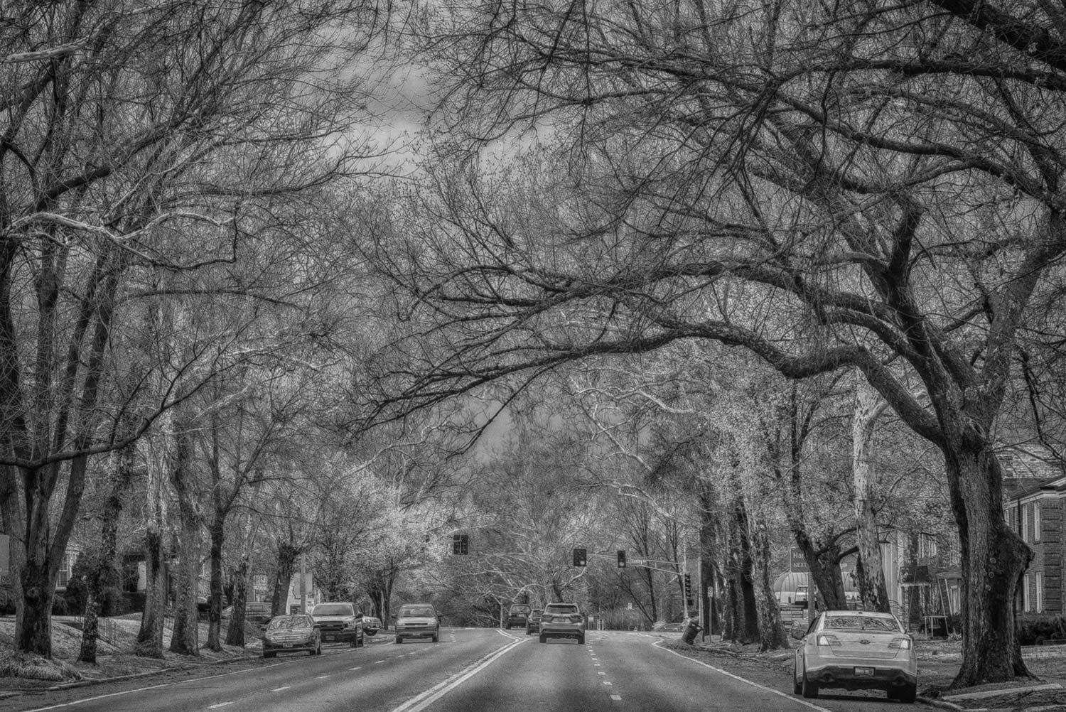
There is a concept in urban street tree gardening called tree stocking. The term refers to tree density. If you plant a tree every thirty feet or so, you end up with continuous limbs and leaves over the street. A canopy street! The trees shade the asphalt, they shade the sidewalk. It is not rocket science. Garrett Street. used to be a canopy street. It was a great place to walk. You can start a tree in a flowerpot. Put it in the ground with a tube around it. There is a prevailing newspaper wisdom that neighborhoods don’t have trees because of structural racism. Certainly that is 5% true. The City of Charlottesville has demonstrated a pronounced reluctance to plant trees in the public ROW. Why is that? I don’t know. If you like shade, if you like trees, plant one a year on your street every year for ten years. Plant noble native trees like these Sycamores in Saint Louis. The planting will transform the neighborhood, it will transform your life.