the floodplains shall be filled, the mountain and hill shall be made low: the crooked shall be made straight, and the rough places smooth.
Albemarle County Supervisors vote 4-2 to further terraform at the base of Monticello mountain.
Mallek and Missel voted to prevent harm in the flood hazard overlay district and to retain the benefits of ecosystem services provided by Albemarle’s green and riverine systems to inhabitants of the County and City.
Duncan, Gallaway, LaPisto-Kirtley and Pruitt voted with the civil engineers to acquire four metal buildings, impervious surface and tax revenue.
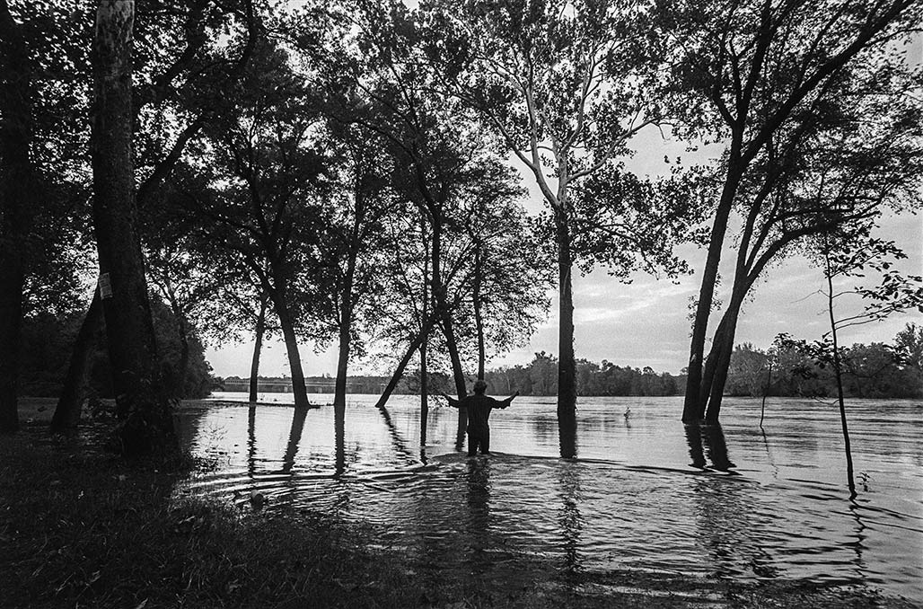
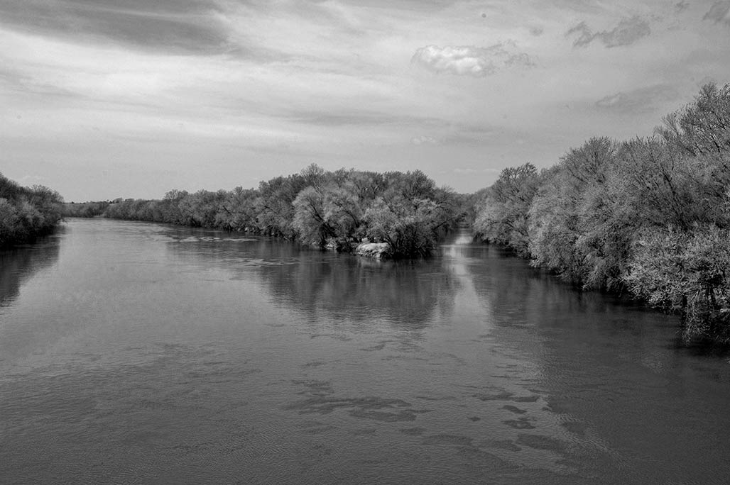
James River floodplain south of Hugenot Bridge
I would like to throw in a different thought than what we’ve been talking about. So we’ve been talking all evening about storm water volume and flows and base flood elevations and floodway fringes and floodplains and 100 year floods and 500 year floods. And I’m well familiar with all these terms, because I spent more than 30 years running a national stream and wetland habitat restoration program across the entire United States, but I also spent over a decade surveying the biological integrity of Moores Creek. So I’m really familiar with this.
I was also vice president of the Belmont Neighborhood Association. I lived there for many years. So I know that neighborhood really well. I know the county side really well. So we’ll just establish that, but we haven’t talked about the other purposes that a floodplain provides.
It is not simply a zone where water is stored during a high water event. It does serve to dissipate the energy of flood waters. Yes, you do want them to be able to spread out and slow down, because they’re less erosive than if you push them into a funnel and let them go really fast, and that’s why we don’t like filling in the floodplain, because it constricts that flow and makes it go fast.
So we can accept the engineers analysis that they say that because this is a backwater fill situation where the water, as the Rivanna River, rises, it backs up Moores Creek, but that they have done all their calculations to say that this small area fill will not raise the base flood elevation. Fine, I’m not going to argue with that.
All right. I’m not an engineer, although I do work with a lot of engineers, but we haven’t talked about the fact that there’s other things that go on in the floodplain that are also really important.
This is habitat. This is not simply an exercise in water flow, but it is also a habitat where many different species depend on that riverine habitat.
Riverine is not a word that we’ve heard tonight that refers to that unique habitat that exists along the river. And those of you who canoe or hike or spend a lot of time in the water understand that that is a different environment than the upland environment.
So to quote the Department of Wildlife Resources, Moores Creek, which flows to the city of Charlottesville, is a tributary to the Rivanna. For decades, urbanization and manipulation have degraded the habitat and water quality of Moores Creek. And it goes on and talks about the potential for Moores Creek to be restored, and notes that multiple species of greatest conservation need listed in Virginia’s wildlife action plan could potentially live in Moores creek or the Rivanna river, and they go on to list all the different species.
Just because we have urbanized the watershed doesn’t mean we should continue to degrade it, just because we thought it was a good idea decades ago that we would put industrial uses along a river that that’s still a great idea.
Zoning can be old and stale and a bad idea, and so the underlying zone here is a bad idea, and I understand that that’s not what’s before us tonight. What’s before us is, can we let them fill in the floodplain?
So there’s a reason why the Comprehensive Plan listed this as parks and green systems. It’s because it’s a flood plain, right? That is why, and the floodplain isn’t just about floods, as I said. So I would like to mention some of the other stakeholders who are not here tonight to testify. And I’m going to save you me rattling off hundreds of species and put you in a coma. I’ll just list a few, the great blue heron, the little green heron, the salamander, the kingfisher or the red bellied woodpecker. I could go on and on with a list of aquatic and riparian species that depend on that habitat. And when we fill it and we destroy it, we diminish that.
So you might say, well, this is just a small area. We’re just going to destroy that small area, because you will destroy it when you fill it and put industrial uses on top of it. But my mom used to use this phrase. You’ve probably heard, death by 1000 paper cuts. That’s what’s wrong with Moores Creek, that’s what’s wrong with the Rivanna river. And so I don’t want to continue to do bad things just because FEMA says, If we pile a bunch of dirt tall and high enough, we’ll be outside the floodplain.
We can engineer just about anything. And I’m going to give you a quick example, I promise quick, that will help you understand the fallacy of this type of thinking.
Let’s just talk about what you can do regulatorily. We could pipe all the creeks. We could get permits from the Army Corps of Engineers. We could pipe our creeks, we could put dirt on top of them, and then, guess what? We won’t have floodplains. Then we could develop on top of all of the prior creek areas, because we could have more industrial use.
Isn’t that great?
No, it’s not great, because rivers and riparian systems provide so many other benefits, habitat areas of respite, quiet, solitude, and habitat for species that, frankly, don’t survive and thrive in other places. And so it’s up to you, if you want to take the attitude that with good engineering and enough bulldozers, we can make it work, and we can meet the federal regulations, but we’re not hitting the spirit of the law, which is to try to protect the aquatic resources of our state. So I’m just, I’m going to leave it there.
I’m opposed to this application. I’m opposed to all filling of floodplains for that reason. And there’s a reason why the Comprehensive Plan said this should be parks and green systems, and I’m sticking with the Comprehensive Plan. I’ll leave it there. I’ll only talk again, if there’s some technical thing that I want to object to, but that’s where I stand. Thank you.–Commissioner Karen Firehock December 16, 2025, Albemarle County Planning Commission meeting
Albemarle BOS will vote the fill up or down January 14, 2026. There is a petition asking them to deny this application to fill, please consider weighing in.
I certainly do not disagree with the technical attributes my colleagues have shared and I will go on record by saying I hate this image that I’m looking at right here. Look at the neighborhood to the left of Franklin St. What socioeconomic band do you think those people are in? Where else in our county would you see something like this?
Q-Proximity to an industrial park?
A-Right! I mean, talk about design injustice, on top of all the things that my Commissioners have said, there’s a reason why the comp plan says what it says. There’s a reason why we don’t commonly build in the floodplain. There’s a reason why you can’t put a building on there today. Like those reasons are there for a purpose. I won’t go ahead and beat the drum that my previous two Commissioners have. I certainly agree with them. They’ve said it so eloquently. So I’m a pretty hard no on this one.– Commissioner Corey Clayborne 4/22/2025
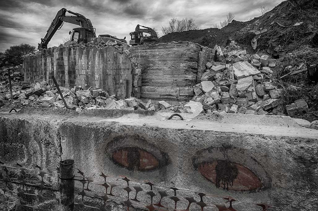
Bulldozer in the foreground, Monticello in the background, floodplain in between.
There’s lots of things that we can do with engineering, with big machines and modern equipment. I mean, there are lots of things that one could do.
And so we do have the ability to build up the soil and help create an island, an elevation that will then put a structure that is out of the 100 year floodplain. That’s true.
We also could pipe the creek and pave it over and then we wouldn’t have to have a buffer. You could actually get a permit from the Army Corps of Engineers to do things like that.
But should we?
That’s where I’m coming from. The 100 year floodplain has a very important hydrologic function in allowing, during a storm, as a water is rushing down, because it has this area it spreads out and dissipates the energy of the water and then some of that sediment load actually drops out in that slower water at the margins. That’s why floodplain soils are so rich, that’s why people like to farm them, because it’s some of the best soil, because that’s where those floodwaters dissipate and lose their energy.
When you constrict the area that the water is flowing through it goes faster. So on a large scale, looking at the whole area, I understand what Mr. Pohl is saying and I understand what Timmons has said, that this will not raise the elevation of the flood overall.
But I’m also looking at this from two perspectives; one is death by 1000 paper cuts, which is all the little fills cumulatively altogether, I don’t have the confidence that we’re looking at it from that perspective.
The other aspect is, again, what I just said about floodplains. They have a purpose and we really should not build in the floodplains. Albemarle County is actually more restrictive; we don’t let you put subdivisions in the floodplains.
You know, our neighbors in Charlottesville allowed a development of housing in the floodplain through an area which I used to kayak when the water was up.
And too bad for those folks when we get another big storm.
I believe very strongly and I have a 35 year career in floodplain and watershed management, and so I’ve spent my whole life trying to keep people out of floodplains.
I would also suggest to you that the zoning, yes is from 1997. But in our comp plan, never mind the park thing for a moment to my commissioner at the other end of the dais, they’re not suggesting this become a park necessarily, but it’s designated as green system because the county did go along and say all of these floodplains, we’re going to call them green systems.
Don’t always think of the Earth as just a place where we are going to recreate or not recreate. There are other ecological functions that are going on there for biota, for salamanders, for all kinds of other critters that are also under our stewardship.
Where I’m coming from is I’m not in favor of allowing fill in the floodplain.
I think that zoning can be old, zoning can be wrong. Zoning can be a bad idea. I think this zoning is outdated. I agree with Lonnie. There are a lot of a lot of reasons why we developed along rivers, that was because that was a transportation system. We had to move goods on the Rivanna. We put goods on batteaux on the Rivanna and sent them down to Richmond. So you know, there’s a lot of reasons why people develop near rivers, also for water supply.
But today, putting industrial along our rivers is also a bad idea. So I don’t think the zoning is good. We’re not here tonight to decide about the zoning, we are here to decide whether you think it’s OK to fill in the floodplain. And I’m going to stick with the comprehensive plan. I think it was wise to say that this is a green system and I don’t care if no one ever recreates in it. So that’s where I’m coming.
I have a lot of hydrologic reasons and ecological reasons for the way that I am presenting my position tonight. I don’t think we’re getting a huge return for allowing this site to become this industrial use by getting it out of the floodplain. That’s it.
I will now step down off my soapbox and yield to my colleagues.–Karen Firehock April 22, 2025 Albemarle County Planning Commission
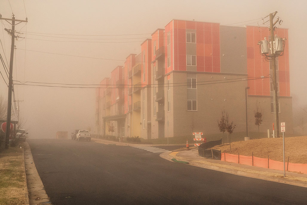
The City is concentrating its affordable housing investments in quadrant four. The area has some of the best views in town, easy access to the Interstate, close to parks.
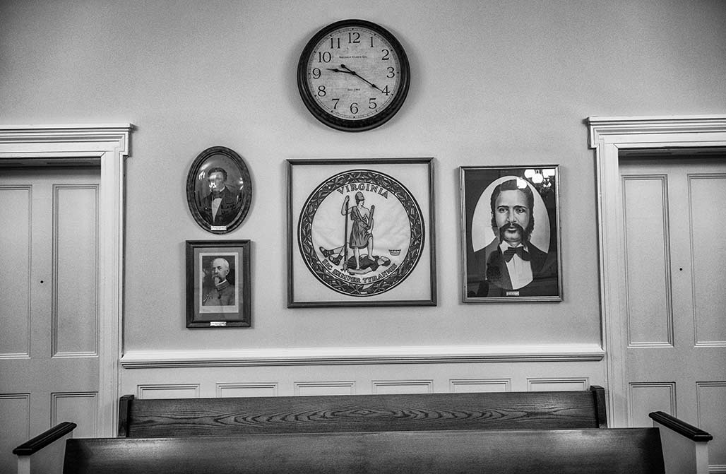
LanCoVa Courthouse
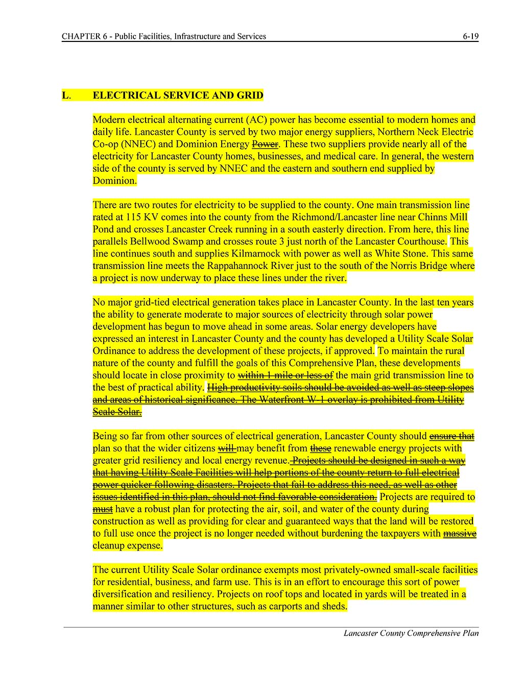
I attended a Lancaster County Planning Commission meeting September 16. One of the items of business was edits to the draft Chapter 6 of the LanCoVa Comprehensive Plan.
The Commissioners voted to strike what I considered to be good and necessary language from their Comp Plan.
Why did I consider the language important? Take the time to watch this video from WTVR.
Comprehensive plans should support the residents and the environment of an area, not the rich and powerful.
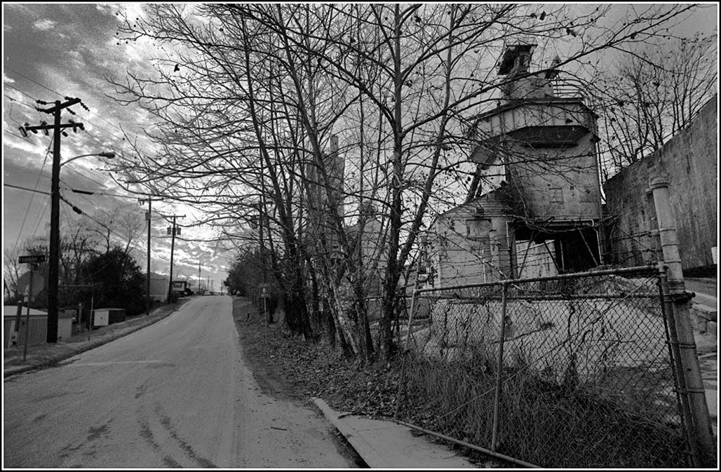
March 1 City Council endorsed the affordable housing plan, the lead piece of the three part Cville Plans Together effort. The three easy pieces, the housing plan, a rewritten “Comprehensive” plan and a rewritten zoning ordinance. Who will make the money from this effort? Who will loose?The 4.86 acre H.T.Ferron plant, once zoned for manufacturing, is now zoned for PUD. No one agrees what PUD is. That is what is so wonderful about PUD. You see what you want to see. Possibly we’ll rezone the entire city PUD?
People are busy. In the fog of current events bad things are happening. Help stop this one, James River Water Authority’s attempt to push the Monacan people out of history…
The Army Corps is seeking public comments until midnight tonight, Sunday June 7, 2020
Please write to the Corps and tell them you do not support this project and ask them to choose an alternative pipeline terminus that does not destroy Rassawek.
Email your comments to:
steven.a.vanderploeg@usace.army.mil
Include your name and address;
State opposition to JRWA’s permit application, it is not in the public interest.
State that Rassawek should be preserved as an important part of national, Virginia, and tribal history.
Request a public hearing on the permit application.
Request that the Corps prepare an environmental impact statement because of the intensity of the proposed impacts to Rassawek; and
Send a copy of your comments to:
jessica@culturalheritagepartners.com
Preservation Virginia listed Rassawek on their “2020 VIRGINIA’S MOST ENDANGERED HISTORIC PLACES” report saying:
Rassawek
Rassawek, the historic capital and sacred site of the Monacan Indian Nation, located at the confluence of the Rivanna and James River in Fluvanna County, is in danger of destruction by a water intake system proposed by the James River Water Authority.
Rassawek contains significant archaeological deposits and potentially likely burials, and is considered one of the most important archaeological sites in Virginia. The Monacan Indian Nation as well as many organizations have voiced their opposition; however, the permitting process for the water project is moving forward.
About the proposed water station, Chief Branham of the Monacan Indian Nation stated, “Rassawek was the place to which all other Monacan towns throughout our expansive former territory in Virginia and North Carolina came to pay tribute, perform ceremonies, and share the joys of family and fellowship. Our capital city was a contemporary of Jamestown, but much larger and more complex, and it lasted as a community far longer. It remains for us a sacred place of great cultural significance, and it is for all Americans a place a historical significance. Surely, the many Monacan ancestors buried at Rassawek deserve to remain in peace. If the Monacan people ever decide their site may be excavated, it should be done carefully and collaboratively over decades, as has been done at Jamestown and Werowocomoco – not destroyed with salvage archaeology.”
On alternatives to the water station, Chief Branham stated, “The project proponents have been compelled by the federal government to identify a dozen routes as an alternative to their current plan, but they persist in pursuing the one that would destroy the heart of Rassawek. The Monacan Nation has expressed public support for exploration of one of those routes, in particular, because we believe it has the greatest chance of delivering water to that community without sacrificing irreplaceable history and disturbing burials on sacred ground. We will work with all parties to advance investigation of this alternative.
Those who say one cannot have both development and preservation offer a false choice.”
While Preservation Virginia does not oppose Louisa and Fluvanna Counties’ needs for a new water source, alternative locations exist for the water intake project. Preservation Virginia encourages the James River Water Authority to locate the pump station at a different site that suits local water needs and does not destroy this significant and sacred place.
In a state that prides itself on preserving history, Native American heritage has too often been overlooked, and in some cases, deliberately destroyed. This legacy of neglect makes it even more crucial to preserve Rassawek.
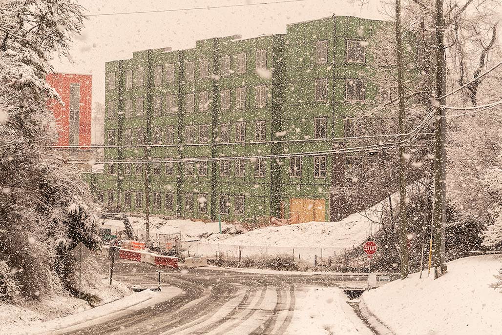
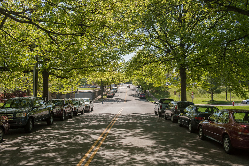
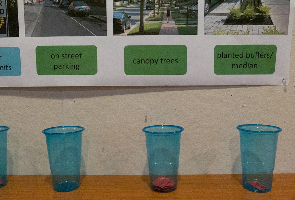
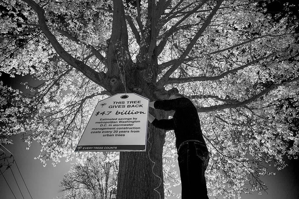
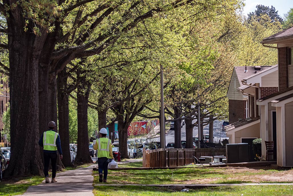
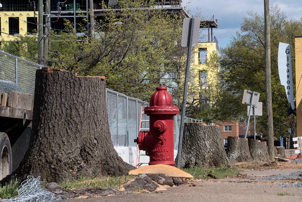
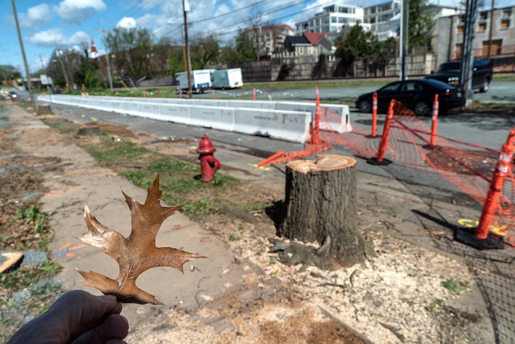
Garrett Street in Charlottesville, between Ridge Street and Avon, has excellent “green infrastructure”. It is a canopy street. Trees provide shade and shelter, and lower temperatures in the summer. In 2006 the Charlottesville City Council adopted a 2025 Vision. Item five of the eight point vision was “A Green City” The City adopted a plan in 2016 to guide the morphology of its streets. Citizens were involved in the development of the plan. People like canopy trees. Shade is a necessity in a southern city if you intend to walk in the summertime. The Garrett Street trees have been celebrated over the years. In the last decade development pressure has focused on this corridor. But still, in the time of COVID-19, a number of the trees remain. (construction workers maintaining distance). This past week, seven Garrett Street corridor Pin Oaks were dispatched. 10-15,000 square feet of shade gone. Over a million leaves, gone. Carbon sequestration gone. Apex Energy is building an eight storey energy efficient structure to the south of the stumps . The landscape plan for Apex’s new corporate headquarters shows these noble oaks being replaced by pagoda dogwoods, a flowering plant, a small deciduous shrub that grows to twenty feet, with a trunk up to six inches in diameter. Token trees. The proposed plantings will not provide the environmental services that these trees brought to our City. This canopy street destruction is deeply discouraging. According to talk on the street, the Apex building is being designed by William McDonough + Partners, two thoughtful companies… Sometimes green is not green.
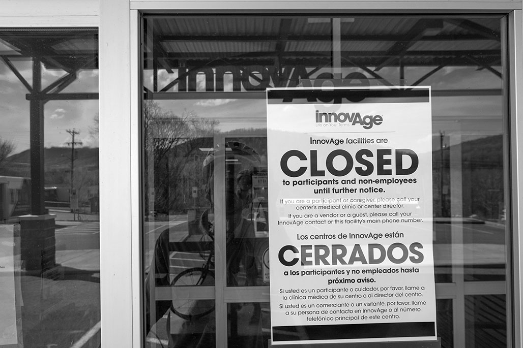
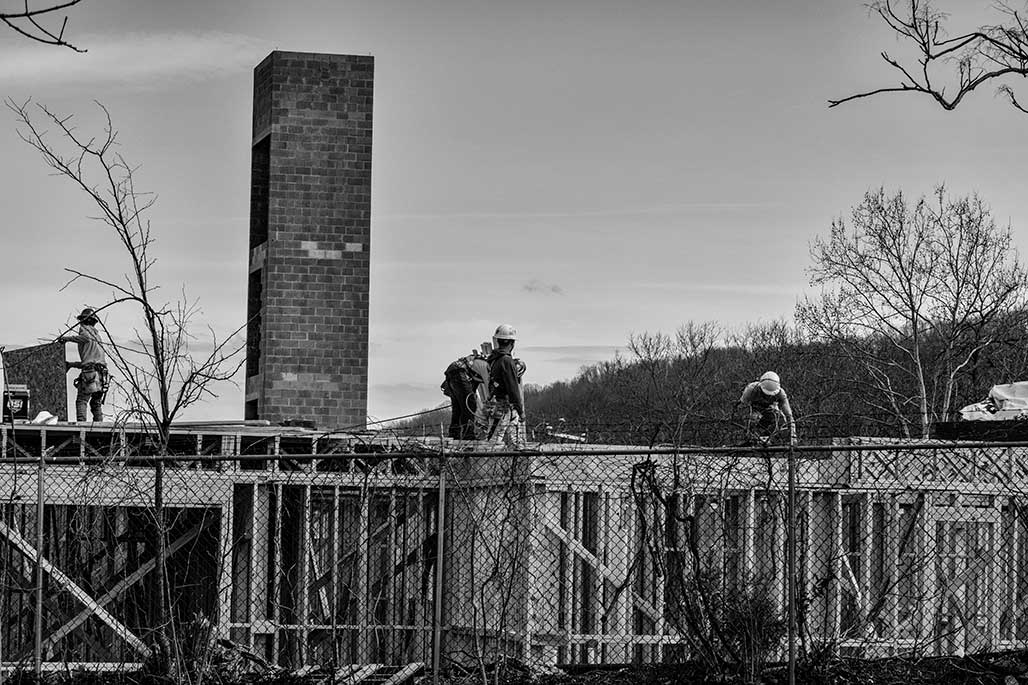
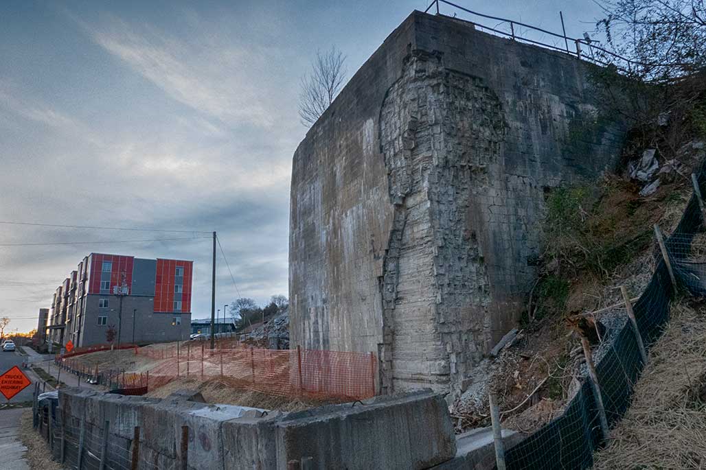
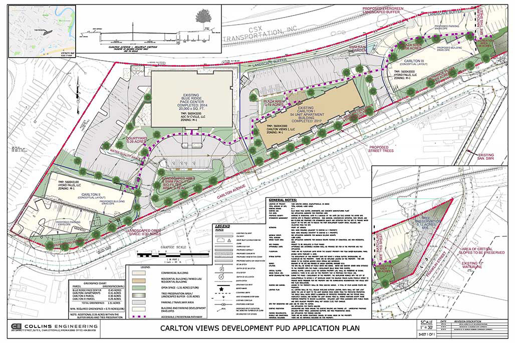
Work continues on multiple fronts on the Carlton Avenue PUD in East Belmont Carlton on the old 4.855 acre HT Ferron site. When complete the site will have a total of 154 affordable units. The development is happening in phases.Phase 1 was the PACE center. Medical care, dental, medications, transportation, physical therapy, and social support. All-inclusive care that helps loved ones stay independent and in their own home. All-inclusive Healthcare. Currently they are closed. Phase II was Carlton Views I. 48 Units I think. All affordable, all leased up… Phase III, Carlton Views II is currently under construction. Not sure regarding how many units. 48? 54? Will check. All affordable…Phase IV, Carlton Views III will sit on the eastern-most edge of the lot. This piece of concrete is currently being busted up and removed to make way for the 3rd building of 48/54? affordable units. Will checkxxxxxxx. Place holder here. The quality of “open space” provided to residents remains to be seen.